Orientation for more advanced and well trained adventurers (Explore The Backcountry)
Orientation guide for trained people who want to walk through the absolutely untouched bush and without the help of a helicopter to the nameless spring waters of the upper Whitestone River/Yukon Territory to finally reach the Bering Sea via the Porcupine and Yukon Rivers (not suitable for everyone).
|
|
|
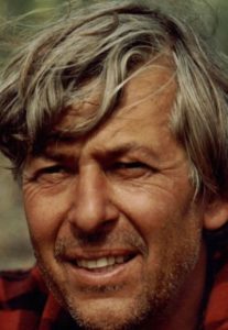
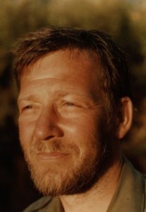
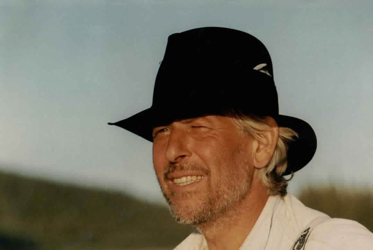
by Danny Hildebrand and Dr. Bruno Benischek | Translation Hap Woodson
The Whitestone River and the Upper Porcupine River are ideal to those who are relatively experienced in paddling; ideal to those who look for the totally untouched wilderness on the one hand and who are physically able to cope with the strains of hiking alone through the bush to the sources of the Whitestone on the other hand; that is to those who are willing to undertake such a trip of eight days under the before mentioned conditions.
What is extremely dangerous with this tour is the fact that you are totally alone in the untouched wilderness without any possibility of calling for or getting help (today it is possible to take a PLB with you). Hence, for safety’s sake, this tour is recommended to be undertaken by at least four persons and dissuaded for learners. The experienced wanderer and canoeist, on the other hand, will meet with numerous unforgettable adventures as well as the satisfaction of having done something extraordinary, always providing that he planned the tour thoroughly before. He will be rewarded by clear and fast water without proper rapids, untouched nature with a variety of wild animals as well as fine weather during most of the tour. A crew of to men (us in 1985) in a 16 foot long canoe needed 33 days to get from Dempster Highway to Old Crow, but we were not under any pressure of time. The crew could have been in Old Crow 8 to 10 days earlier, yet, four weeks at the least are recommended when undertaking a tour of this kind.
- River Classification: Grade 1-2 (no rapids)
- Best time to travel: June to August
- Nearest emergency communication: Dempster Highway, Old Crow (PLB)
- Length: 12 km portage, 600 km waterway (50 km to Whitestone River, 120 km on Whitestone River down to the mouth of Miner River, 200 km from Miner River to Bell River, 200 km from Bell River to Old Crow).
- Width: 5 to 250 meters
- Time to allow: 25 days from Dempster Highway to Old Crow
- Maps 1: N.T.S. 1: 250 000
- Ogilvie River
- Hart River
- Porcupine River
- Eagle River
- Bell River
- Old Crow
- Maps 2: 1: 50.000 (Portage from Dempster to Whitestone)
- 116 G/9
- 116 G/16
- 116 H/12
- 116 H/13
- Hazards: Remote wilderness, very difficult, long and arduous portage, long journey on the Rivers, swift water in many bends, logjams, sweepers, sandbars and boulders.
- Directions: Via Dempster Highway, 56 km past Ogilvie Bridge
Recommended Stages
The starting point of the tour on the Dempster Highway can easily be found, it is about 56 km north of the Ogilvie Bridge. The Ogilvie River, which basically runs along the Highway to about 50 km past the Ogilvie Bridge, leaves the highway at that point and turns to the right (east). This is 7 km past an airfield on the right side of the Dempster Highway which is well marked and thus can’t be overlooked.
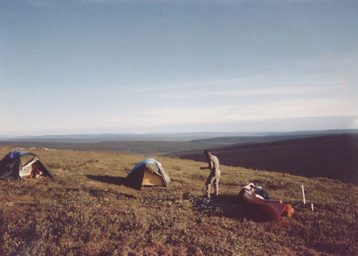
On the point where the Ogilvie River turns to the east the Dempster Highway begins to rise to the mountains. This point is easy to find because a creek which always has running water flows into the Ogilvie River there and is thus crossed under the highway. Then you must go on till you have reached the highest point of the highway, above the timber-line, where there is a deposit for the road gravel run by the road surveyors. This deposit is at about 100 m to the left of the highway and a gravel pass leads to it. This is exactly the starting point of the tour (see photo below). To its left is the ridge or flat peak when looking NNW (Dempster Highway behind you). Four valleys stretch out in front of you then; the one in your line of sight and to the right of the starting point, being 4 km long. The second one borders on the first, extends at right angles to it in NNE direction and is again 4 km long. The third valley runs parallel to the first, is 3 km long and again borders at right angles to a valley parallel to the second one. The latter contains the first navigable creek where as the creeks of the three valleys mentioned before are too small and don´t have enough water to be navigated in summer.
The portage to the first navigable creek is therefore at about 12 km long, which means a footpath of 60 km because carrying all the proper equipment makes it necessary to walk the route five times. This march should – if possible – lead people along the creeks and valleys because it is important that water is available for the whole time. A well-trained group is able to do the route in 4 days.
1st stage
The first kilometer of the tour can easily be covered with no obstacles or trees standing in your way. Then you have to cross quite a steep slope overgrown with trees and bushes to reach the valley to the right. The best thing is to go as far as the creek and then along the creek as far as possible. After three kilometres there is a relatively open area to the left of the creek, which is only covered with moss and grass. You can’t miss this open area because it can clearly be recognized as such from the starting point of the tour. If you want to avoid camping in the woods, this is the only acceptable camping-place although the ground is relatively moist and contains numerous deep holes with so called „niggerheads“ in between. Yet, there is a flat place for 2 or 3 tents, the creek is not far away and provides you with good drinking water.
2nd stage
Instead of following the creek it is best now to cross it and march in a slanting direction to the second valley. After one kilometer you reach a cutline which runs through the whole valley and makes orientation so easy that it is no longer necessary to mark the route with little coloured hunter flags. Following this cutline till it crosses the creek you reach a point which is quite apt to act as a camping-place for the night.
3rd and 4th stages
The 3rd and the 4th day stages of your tour lead along the aisle to the end of the valley. However, this march was not at all easy because there was no beaten path. Numerous holes, marshy country and „niggerheads“ render the march difficult and involve the danger of breaking one’s leg. Yet, it is easier to follow the way described above than to walk along the right slope as we tried for one day.
5th and 6th stages
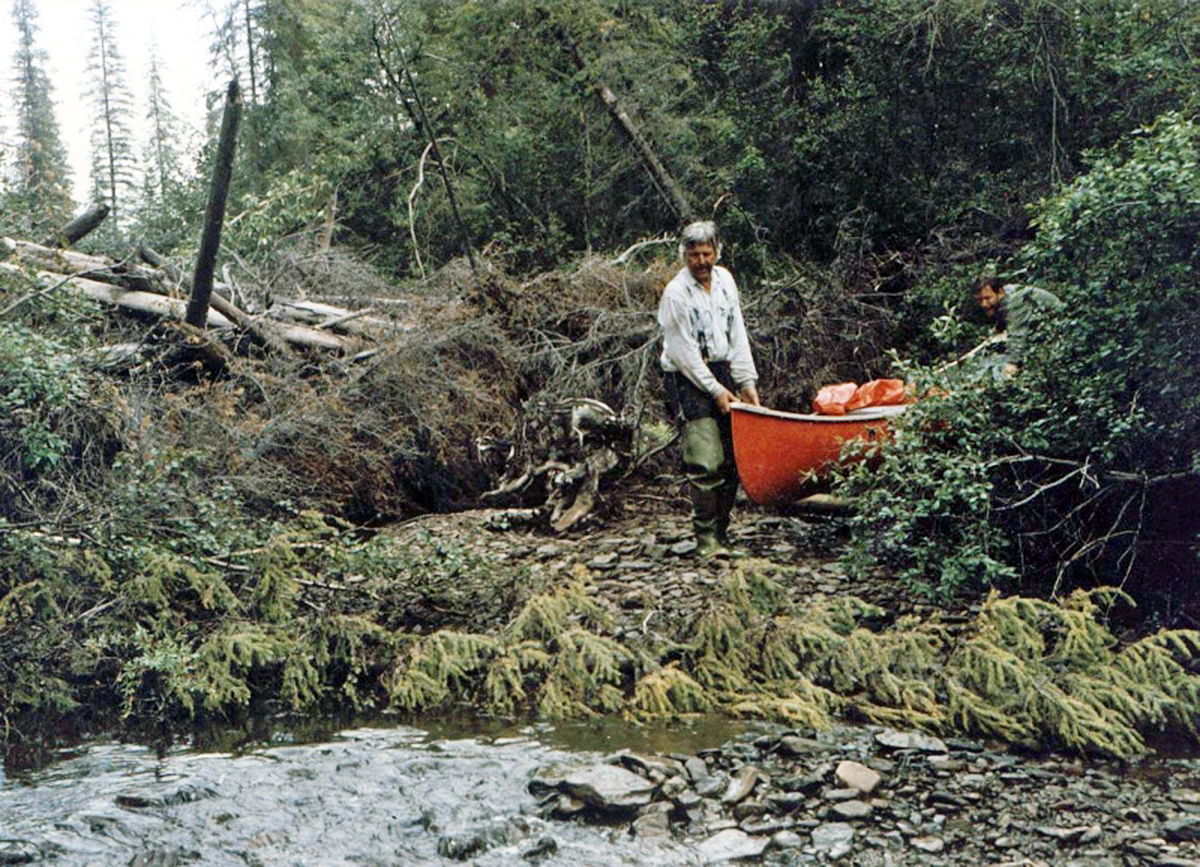
This aisle ends with the second valley, yet, there is a new one at right angels to Dempster. Before reaching the creek of the third valley you go towards the valley till the creek meets the steep slope. From that point on it is better to cover the following 3 km in the bed of the creek itself although it is very difficult with the creek having to little water for paddling at towing. Additionally, overturned trees block the creek, thus making navigation almost impossible. You can use the canoe as a means of transport for one quarter of the distance only; the other three quarters have to be walked. In spite of all these difficulties, this way is by far easier than the one through the bush; and there are also two fairly great sandbanks in the river-bed which offer two good camping-places.
The creek suddenly and quite astonishingly flows into another creek which runs through the fourth valley. Now it can nearly be regarded as a river because of the width of its bed. From now on you can go by canoe; only in some places is there the need to tow.
Canoeing
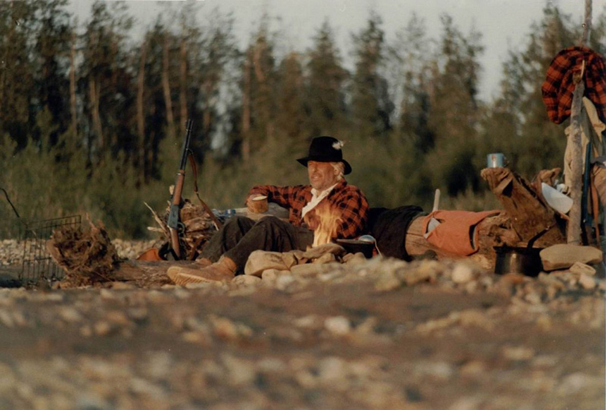
The wide creek makes paddling eventful as well as easy. Calm deep water changes to fast water in numerous small turns. There are no rapids, yet, you must take care of certain obstacles like trees or bushes (logjams) in the turns. Every now and then there are swells and back eddies. There are a variety of camping-places, the water is clear, containing a lot of fish, above all graylings, sometimes catfish and pike.
All the tributary creeks shown on the map were dried up during our tour; a few kilometres before the creek flows into the Whitestone River there are two tributary creeks (the one is coming from the right, the other immediately afterwards from the left side) which had enough water. Fishing was splendid there, too (grayling, she fish, pike).
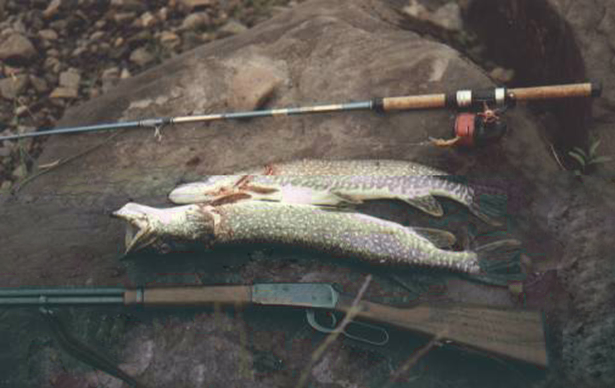
After 50 km this creek flows into the Whitestone River which comes from the left side out of a wide valley. There is a back eddy, but it is not dangerous. Right where the two rivers join, there is a huge sand-bank on the left side offering good camping-places as well as good places for fishing (she-fish). From this point on you go along the Whitestone River for 120 km till the Miner River flows into it. The Whitestone also has clear as well as fast water. Its bottom is either sandy or covered with light pebbles. Again you won’t have to cope with rapids, yet, there are many narrow channels with swells in the turns, as well as obstacles like trunks or bushes you must take care of. Although there are a variety of fish. It is much easier to catch pike and catfish too(bottom fish). You can choose between a lot of camp sites; best are sand-banks which protect you from mosquito’s and unexpected appearances of bears.
The tributary creeks are difficult to find because they often flow into dead branches of the Whitestone River and have little water in midsummer. Whitestone Village no longer exists, just a few dilapidated log-houses can be found on the left side of the river a couple of meters above the site where the village once was. Shortly before the junction with the Miner River are a few islands so that the river, now being relatively wide, shows some channels, making the choice difficult with the low water-level.
As the Whitestone River and the Miner River rise in the Ogilvie Mountains, the Miner has clear water and heavy current which makes it appear more gigantic than the Whitestone which flows more sluggishly. At the junction there is a huge gravel-bank which is not good for camping because of its large pebbles. Yet, 3 km farther there is an ideal camping-place on the left side just before tjoining with the Cody Creek and there is the best possibility of catching graylings. The river then grows wider and wider and the velocity of flow steadily decreases. The water remains clear, but fishing is reduced to catching pike which can be found in great number.
The following part offers only a few good camping-places because sand-banks are lacking, the shore is muddy and the land is characterized by shrub and marshy meadows. Five miles above the junction with the Little Porcupine River there is an old Indian camp used by lumber-jacks from Old Crow with a comfortable hut. Further there are some cabins, but they are hardly seen from the river and often very desolate, that is they can’t even be recommended as make-shift beds. From the junction with the Bell River onwards the velocity of flow increases slightly but the clarity decreases because the Bell River brings a lot of sediment with it. Thus, there are various sand-banks which again offer better camping-places. There are even some camps and cabins partly used on the shore.
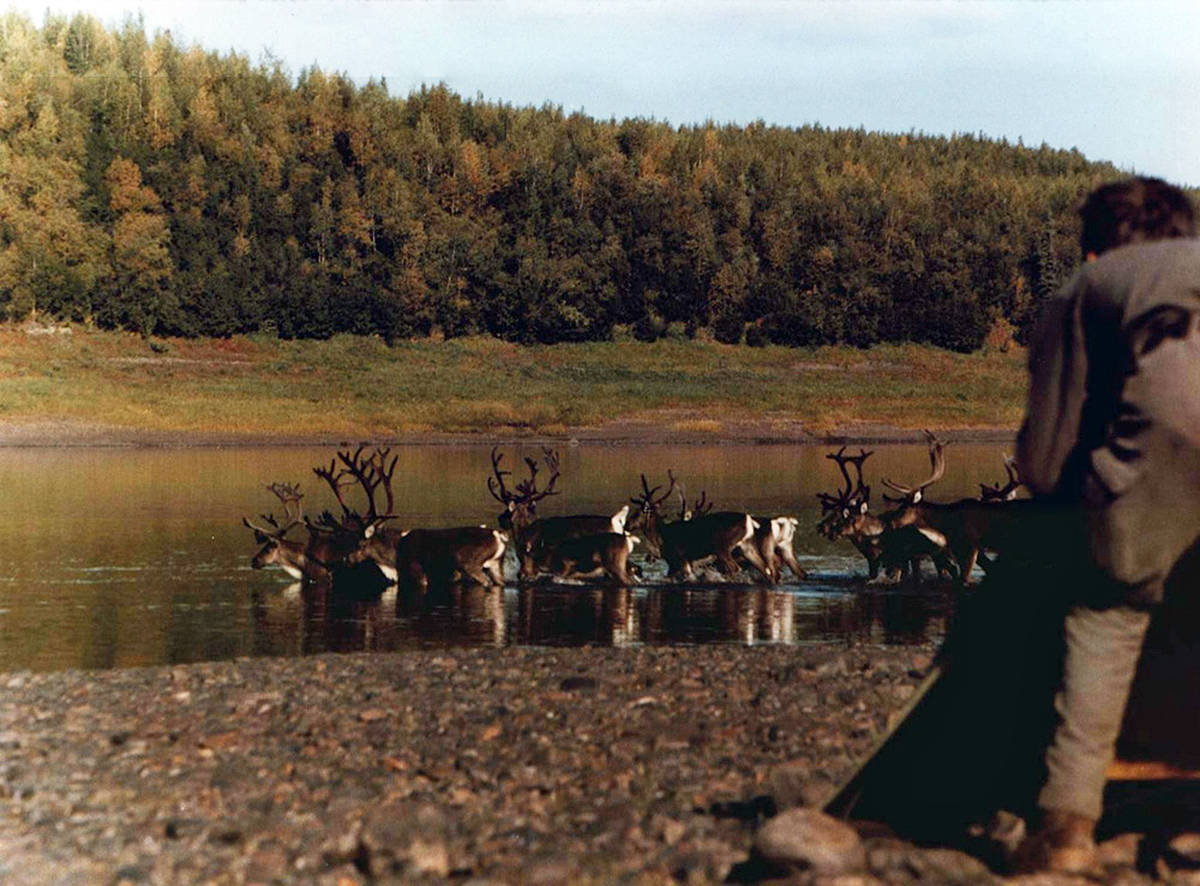
During late summer and autumn you can find a lot of caribou in the area between the confluence with the Bell River and Old Crow. There are not many difficulties when paddling along the whole Porcupine River. Even if the water-level is extremely low you can choose between many shallow channels running between a lot of sand-banks.
All the way down to Old Crow, one now and then encounters Indian inhabitants of the place who are out hunting and also occupy the occasional cabins on both sides of the river. In Old Crow you can easily be flown out by small propeller machines. The canoes, however, must remain on site….
END
Contact Form